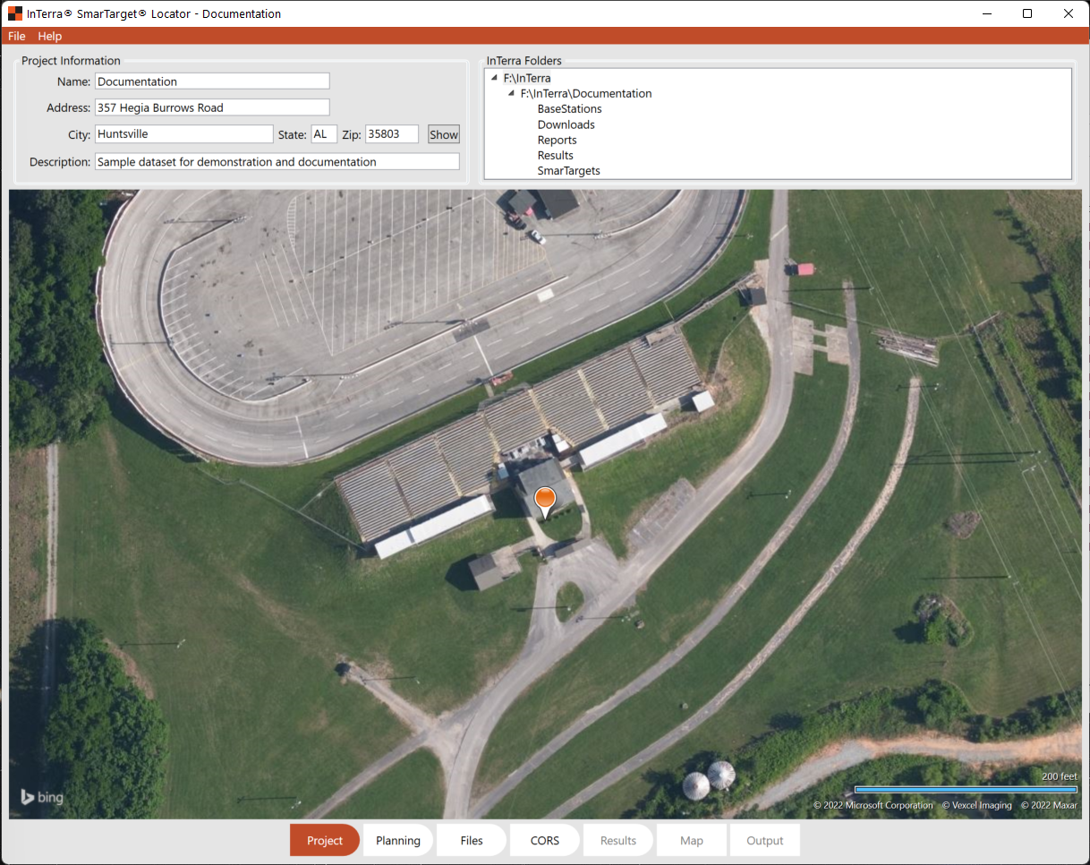
Project

Populate this dialog with the project details including address, then click "Show" to see an aerial image of the planned site. To aid in planning for a mission while still in the office and before flight, use the Locator Project tab to create the project and type in the site address (at a minimum use the zip code), to see an image of the area displayed at the bottom of the Project window. Zoom in and out and pan as needed to see the site overview in Bing maps.
In the upper right portion named InTerra Folders will be the project data directories. Double clicking any of these folders will launch Windows File Manager in that folder. Below is a listing of the files stored in each folder.
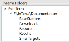
InTerra Folders defined:
|
Download Folder: |
Raw files downloaded from the SmartTarget's related to the current project. |
|
SmarTarget Folder: |
Processed data from the downloads, typically these files can be used in other downstream processes if needed |
|
Base Station Folder: |
Locator retrieves data from NGS CORS units and stores in this folder to be used in data processing. If the data has been downloaded more than one hour after flight, and within 14 days of collection then this data is the most complete and in synch with the GNSS data. |
|
Reports Folder: |
Data results in report format. Additionally, the Output.kml file and .csv are in this folder. |
|
Results Folder: |
Results from the processing run with Locator. |
In the Folder pane, the tree can be opened by clicking on the tick to the left of the content to reveal the project file structure. Double-click any folder to open Windows File Manager for quick access to content like Reports to view the output.kml file or to open the Results in a .csv for processing in photogrammetry software. This is a great resource for finding any files related to your project processing, output, or other data related to SmarTarget operations.
Now switch to the Planning tab.