Datumate and InTerra Announce Strategic Partnership to Co-Market and Co-Sell Cutting-Edge Surveying and Mapping Solutions
Datumate and InTerra Announce Strategic Partnership to Co-Market and Co-Sell Cutting-Edge Surveying and Mapping Solutions
Datumate and InTerra Announce Strategic Partnership to Co-Market and Co-Sell Cutting-Edge Surveying and Mapping Solutions
Pikesville, MD and Huntsville, AL – July 24, 2024 – Datumate, a leading provider of photogrammetry and 3D mapping software, and InTerra, a pioneer in GPS-enabled ground control points for the drone mapping and surveying industry, today announced a strategic partnership to co-market and co-sell their innovative technologies to joint customers.
This collaboration brings together Datumate’s DatuBIM, a cloud-based SaaS platform that converts drone and laser scanning data into precise, survey-grade 3D models and maps, with InTerra’s SmarTarget, a GPS-enabled ground control point designed for unparalleled accuracy and efficiency in surveying and mapping projects.
Benjamin Sack, Global VP of Sales at Datumate, commented on the partnership: “Our collaboration with InTerra enhances our offering by integrating their advanced GPS-enabled ground control technology with our comprehensive data analytics platform. This combination will provide our customers with a robust solution that ensures data accuracy, improves project visibility, and facilitates seamless collaboration among all stakeholders.”
Larry Donelson, CEO of InTerra, added: “Partnering with Datumate aligns perfectly with our mission to push the boundaries of drone mapping and surveying. By leveraging Datumate’s DatuBIM platform, we can offer our customers a more comprehensive toolset that not only enhances precision and efficiency but also streamlines the entire project lifecycle from conception to completion. Now, in addition to having GPS-enabled ground control, our customers can streamline model generation, volumetrics, and data analytics.”
About Datumate
Datumate is at the forefront of construction technology, specializing in photogrammetry and 3D mapping solutions that deliver critical field progress data for infrastructure projects. Their flagship platform, DatuBIM, turns drone and laser scanning data into accurate 3D models and maps, providing real-time insights and detailed engineering reports that drive better decision-making and project management.
About InTerra
InTerra is a leader in the drone mapping and surveying industry, known for its innovative SmarTarget product. SmarTarget is a GPS-enabled ground control point that offers pinpoint precision, rugged durability, and seamless integration with any drone and mapping software. InTerra’s solutions empower surveyors, construction managers, and geospatial professionals to enhance project accuracy, reduce costs, and streamline operations.
Complementary Capabilities
By combining Datumate’s advanced photogrammetry and data analytics with InTerra’s precision ground control technology, this partnership aims to offer an unmatched solution for surveying and mapping professionals. The integrated platform will enhance accuracy, improve efficiency, and ensure comprehensive project oversight, making it an invaluable tool for joint customers in the construction and civil engineering sectors.
For more information about this partnership and the innovative solutions offered by Datumate and InTerra, please visit Datumate and InTerra.
InTerra Achieves ‘Made in America’ Designation on Flag Day
InTerra Achieves 'Made in America' Designation on Flag Day
Summary:
InTerra is proud to announce that we have qualified for the prestigious ‘Made in America’ designation. All of our product is designed, developed, and delivered in the USA, and all customer data remains on the desktop.
Press Release
For Immediate Release
June 14, 2024
InTerra Achieves “Made in America” Designation for Hardware and Software
Huntsville, AL – InTerra is proud to announce that, as of today, Flag Day, June 14, 2024, our innovative hardware and software solutions have officially qualified for the prestigious “Made in America” designation. This significant milestone underscores our commitment to American manufacturing and technological excellence.
InTerra’s hardware and software products are not only manufactured and substantially transformed in the United States, but our software is also entirely designed, developed, and delivered within the country. We take immense pride in our dedication to supporting the American economy and ensuring the highest standards of quality and security for our customers.
In addition to our commitment to American craftsmanship, InTerra guarantees that all customer data remains secure and local, residing exclusively on the desktop. This approach enhances data privacy and security, offering our clients unparalleled peace of mind.
“InTerra’s achievement of the ‘Made in America’ designation reflects our unwavering dedication to quality and security,” said Larry Donelson, CEO and Co-Founder of InTerra. “We are proud to celebrate this accomplishment on Flag Day, a symbol of our national pride and commitment to American values. Our customers can trust that they are receiving top-tier products that are designed, developed, and manufactured in the United States, with their data securely kept on their own systems.”
This milestone is a testament to InTerra’s ongoing mission to deliver superior survey and mapping products for the drone industry while maintaining a steadfast focus on customer satisfaction and data security.
For more information about InTerra and our “Made in America” certified products, please visit www.interra.com or contact our media relations team at media@interra.com.
About InTerra
InTerra is a leading provider of advanced survey and mapping products for the drone industry. Headquartered in Huntsville, AL, InTerra is dedicated to delivering high-quality, reliable solutions that meet the evolving needs of our customers. Our products are proudly made in the USA, reflecting our commitment to excellence and innovation.
Contact Information
InTerra
Media Relations
Email: media@interra5d.com
Website
www.interra.com
###
For additional inquiries or to schedule an interview with Larry Donelson, please contact our media relations team at media@interra5d.com.
InTerra, Inc. Receives $100,000 Investment from HudsonAlpha AgTech Accelerator powered by gener8tor!
FOR IMMEDIATE RELEASE
Contact:
Lauren Marin
Media Contact
InTerra, Inc.
Media@InTerra5d.com
Huntsville, AL – September 25, 2023 – InTerra, Inc., a provider of innovative agricultural technology solutions, today announced that it has received a $100,000 investment from the HudsonAlpha AgTech Accelerator powered by gener8tor. The investment will be used to grow InTerra’s product offering and expand its reach into new markets, including the agriculture industry, which is a critical national infrastructure.
“We are thrilled to receive this investment from the HudsonAlpha AgTech Accelerator,” said Peter Funk, CTO of InTerra. “This funding will allow us to focus and accelerate the development of new service offerings to provide farmers, ranchers, and other agricultural professionals information on their land, their most valuable resource.”
InTerra’s products help to improve mapping and make data acquisition more efficient while increasing productivity and profitability. The company’s flagship product is a high-accuracy, low-cost desktop hardware and software platform for drone mappers and surveyors that provides cost-effective data on crops and terrain. This data can be used to make better decisions about irrigation, fertilization, and pest control throughout the seasons.
“Agriculture is a critical national infrastructure, and InTerra is developing innovative technologies to help farmers meet the challenges of the 21st century,” said Larry Donelson, CEO of InTerra. “We are grateful to the HudsonAlpha AgTech Accelerator and gener8tor for their support, and we look forward to using this investment to help serve new customers as well as our great current customer base in the transportation, mining, and telecom industries.”
“We are excited to partner with InTerra as they develop and commercialize their innovative agricultural technology solutions,” said gener8tor Managing Director Christopher Udall. “HudsonAlpha AgTech Accelerator is a highly competitive application and interview process where only the best and brightest companies are selected. InTerra’s team has a deep understanding of the agricultural industry and the needs of farmers and ranchers. We are confident that they will use this investment to make a significant impact on the industry.”
Looking Forward to Helping New Customers
“We are excited to use this investment to help even more customers succeed,” said Donelson. “We believe that our technology has the potential to transform the way that agriculture is viewed, and we are committed to providing our customers with the best possible products and services.”
About InTerra, Inc.
InTerra, Inc. is a provider of innovative agricultural technology solutions. The company’s flagship product SmarTarget® is a GPS-enabled Ground Control Point with included Locator™ software platform that provides drone mapping and surveying companies with high-accuracy ground control at a low-cost desktop solution. InTerra helps farmers with real-time data on their crops. This data can be used to make better decisions about irrigation, fertilization, and pest control. InTerra is headquartered in Huntsville, Alabama. Their website is https://www.interra5d.com.
About HudsonAlpha AgTech Accelerator powered by gener8tor.
The HudsonAlpha AgTech Accelerator powered by gener8tor is a 12-week program that helps early-stage agricultural technology startups to develop and commercialize their products and services. The program provides startups with access to mentorship, investment capital, and resources from HudsonAlpha Institute for Biotechnology and gener8tor.
About gener8tor
gener8tor is a venture capital accelerator that provides early-stage startups with mentorship, investment capital, and resources to help them succeed. gener8tor has invested in over 600 startups and helped to create over 7,500 jobs.
Upcoming Event: Pilot Byte Workshop in Birmingham
April 6, 2023
Dylan Gorman of Pilot Byte is hosting a nationwide series of photogrammetry workshops focusing on drones for photogrammetry and mapping. Some specific topics covered in the daylong event are:
What Is Photogrammetry,
What Drones To Use,
Hands On Mission Planning, and
What Are GCPs
We are excited to announce that a workshop will be held in Birmingham, AL, on April 29th, and Larry Donelson will be the guest speaker at this event. Dylan is offering a 5% discount for our friends if you use the code “InTerra” at registration.
To enroll, visit the Birmingham workshop page on Pilot Byte’s website.


SmarTarget Locator 2.1
February 21, 2023
We are pleased to announce the release of Locator 2.1 with advanced analysis reports, faster processing, extensive bug fixes, project management, and flight planning improvements in an already simple yet powerful workflow. To support this release, the documentation and field manual are completely updated and, as always, are directly available online. Your feedback has driven many of the new features.
All users are encouraged to log in on InTerra5D.com, then select Downloadable, and install this release. While on the site, be sure to check out our updated FAQs for questions about SmarTarget, processing, and drones.
We are so confident that this release is the best tested and most secure version that we are offering a bounty of a free InTerra SmarTarget stainless steel bottle to any user who can capture video or send repeatable steps of a bug or crash in this new release!
Send your notes to support@interra5d.com.
The International Foot with SmarTarget
January 2, 2023
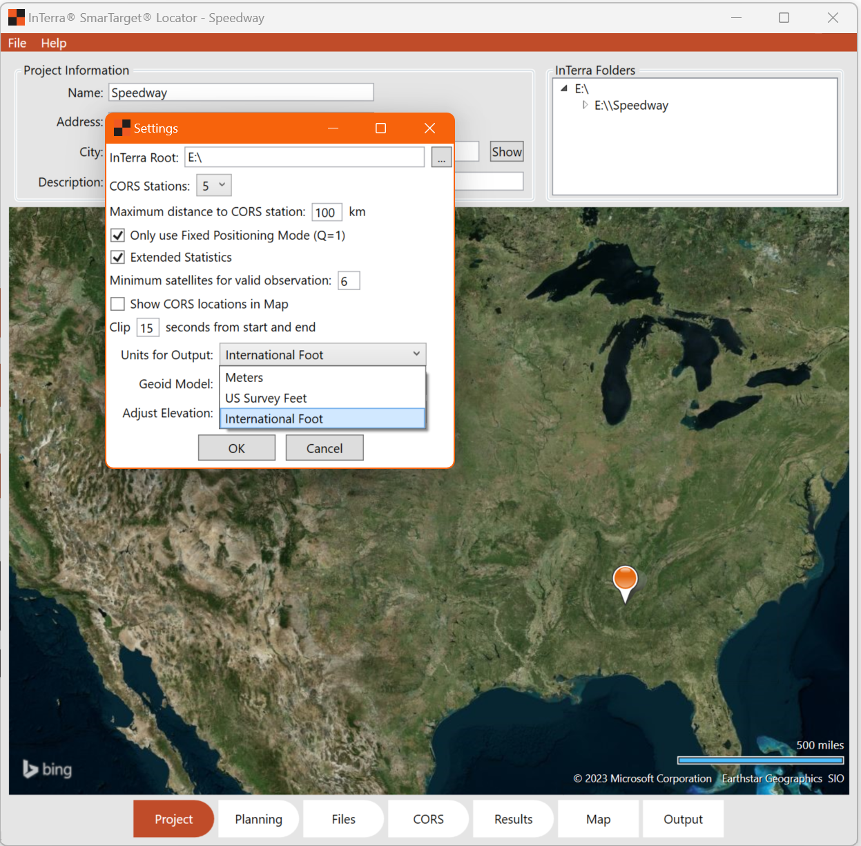
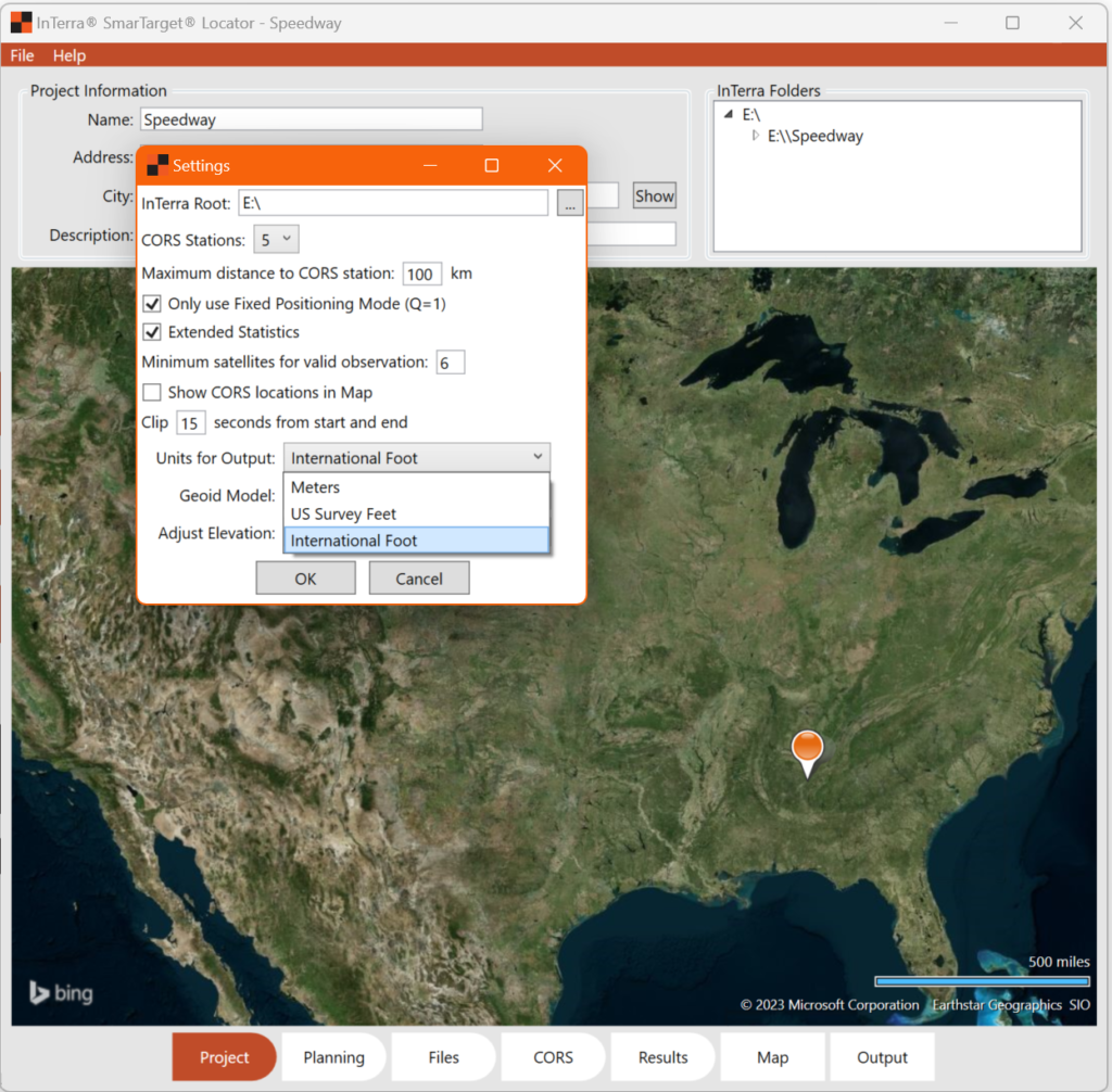
The National Institute of Standards and Technology and the National Oceanic and Atmospheric Administration have officially retired the U.S. survey foot as a unit of measurement. As of January 1st, 2023, The U.S. foot has been replaced by the international foot. We planned ahead for this change when we developed our SmarTarget software. You can easily switch units in the InTerra SmarTarget Locator project settings, as shown in the image below, to ensure that all of your projects are now up-to-date.
You can read more about this change on the NOAA and NIST websites.


